
Developing instrumentation for measuring and modeling planetary and Earth deformations and interactions, and to test theories of fundamental physics
In the field of spatial metrology, Geoazur has involved in spatial data production, acquisition, and scientific mining, including:
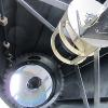
- instrument development, especially related to distance measurements using laser ranging (Geoazur has developed the related technique and owns one of the only two stations worldwide allowing distance measurements between the Earth and the Moon;
- significant involvement in space mission operations related to: JASON satellites for space altimetry, the MICROSCOPE satellite for the test of Equivalence Principle, BepiColombo and Juice space crafts for planetary exploration, the E-GRASP satellite for reference systems and time transfer by laser link, etc.;
- the use of all resulting observation means (laser, GPS, INSAR, altimetry, gravimetry, etc.) for measuring Earth surface deformations, gravity variations, atmosphere variations, and infer information on the internal structure and deformations of the Earth and the Moon;
- the use of all generated data to test the validity of gravitation theories by: considering kinematics (lunar motion observed using laser telemetry, planetary motion faced with radio science observation); measuring the flight times of photons (Lorentz Invariance test using T2L2 experiment); implementing experiments embedded in space crafts (test of Equivalence Principle during MICROSCOPE spaceflight).